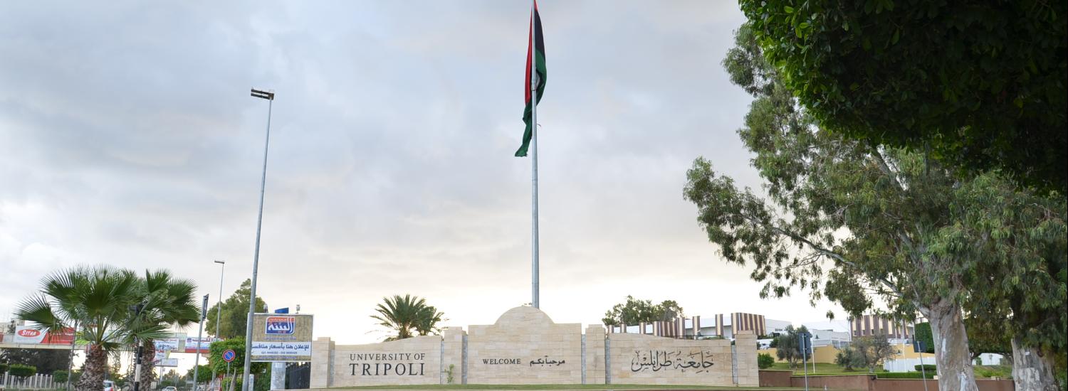
Department of Soil and Sand

More ...

About Department of Soil and Sand

Facts about Department of Soil and Sand

We are proud of what we offer to the world and the community

73

Publications

26

Academic Staff

52

Students

0

Graduates

Who works at the Department of Soil and Sand

Department of Soil and Sand has more than 26 academic staff members

staff photo

Dr. Hamdi Abdalkhaliq Ali zurqani

Dr. Hamdi A. Zurqani is one of the faculty members at the Department of Soil and Water Sciences, Faculty of Agriculture, University of Tripoli, Tripoli, Libya. Dr. Zurqani is a recognized expert as a result of his internationally acclaimed work in the areas of Environmental Information Science, Remote Sensing, Land Evaluation, Sustainability, Pedology, and Soil Science Education. He has conducted research across the world, including the United States of America, and Africa. Dr. Zurqani is a distinguished soil scientist with a wide range of scientific and working experiences in Libya and abroad. He received his M.Sc. (2010) from the University of Tripoli, Tripoli, Tripoli, Libya, and Ph.D. (2019) from Clemson University, Clemson, SC, USA. His major research and teaching activities at the University of Tripoli have focused mainly on Soil Genesis and Classification and the Environmental Information Sciences (Remote Sensing and Geographic Information System). He has published broadly in many journals (e.g., Nature “Scientific Reports”, Geoderma; International Journal of Applied Earth Observation and Geoinformation; Journal of Geological Sciences; Land; Frontiers in Environmental Science; Communications in Soil Science and Plant Analysis; and others). Dr. Zurqani is a member of the Editorial Board for Remote Sensing (MDPI) Journal, counseling outcome and research evaluation. He also was appointed to serve as a Guest Editor for the Special Issue "Applications of Remote Sensing in Earth Observation and Geo-Information Science". In addition, Dr. Zurqani conducted peer-review for many journals including Journal of Environmental Informatics, Applied Sciences, SN Applied Sciences, Remote Sensing, Heliyon, Geosciences, Land, Water, Agronomy, Agriculture, Sustainability, Arid Land Research and Management, International Journal of Environmental Research and Public Health, Natural Hazards, and Conference of the Arabian Journal of Geosciences. He is also one of the authors of the lab manual entitled “GIS Exercises for Natural Resource Management”. Dr. Zurqani has been the recipient of numerous awards and honors: Recipient of Douglas R. Phillips Award for Graduate Students, Department of Forestry and Environmental Conservation, Clemson University, April 12, 2019; the First Place Best Judged Poster (CAFLS) at the GRADS 2019: Clemson Student Research Forum on April 4, 2019; the Second Place Poster at the 11th Clemson Biological Sciences Annual Student Symposium, April 6, 2019; the Second Place Best Judged Poster at the Clemson Student Research Forum on April 4, 2018; and the Third Place Poster at the 9th Clemson Biological Sciences Annual Student Symposium, February 25, 2017. Dr. Zurqani conducts cutting-edge research in the field of environmental information science, remote sensing, land use management/planning, change detection of landscape degradation, and geographic information system (GIS) models. He has focused on his research efforts on the development of new technologies in the field of environmental information sciences, geo-intelligence (advanced geo-information science and earth observation, machine and deep learning, and big data analytics), remote sensing, land evaluation, pedology, land use management/ planning, monitoring and evaluating sustainable land management, change detection of landscape degradation, and geographic information system models.

Publications

Some of publications in Department of Soil and Sand

Simulation of Soil Water Movement in Sandy Soil under a Prairie Field with Hydrus _2D Model

Summary: One of the main characteristics of trickle irrigation system is that water leaving an emitter enters the soil and moves both laterally and vertically. There has been much speculation on the shape and moisture distribution within the wetted soil volume. This knowledge is important in the design, operation and management of a trickle irrigation system. A simulation study of soil water distribution under a prairie field in Tripoli Libya, by the use of the two dimensional model Hydrus 2D model was carried out. Sandy soil was irrigated using surface point source with application rates of 1.5, 2, 2.7, 3, 3.5, 4.5, 4.8 and 6 l/h. The surface wetted radius, vertical advance of wetting front and the distribution of moisture content in the soil profile were determined. Three statistical criteria were used to compare the quality of simulation results, such as mean bias error (MBE), root mean square error (RMSE) and Theil’s Inequality coefficient (U). Simulation positions of the wetting front were in agreement relative to the observed measurements of the wetting front. Specifically, in the lateral, the experimentally determined wetting front was closely estimated by the model. In the downward direction the simulated wetting front advanced much slower than the observed especially at later stage of infiltration. Considering the difficulties in estimating the dynamic water conditions in the field there was generally good agreement (especially in the lateral direction) between the measured and simulated values. In the deeper downward direction the simulated moisture content distributions were less than the measured. On the other hand, the Hydrus_2D model described the water content distribution quite well at relatively high levels of moisture contents; however, it did not do as well at lower moisture content. The discrepancies between the simulated and measured values may be due to variation in the size of the surface source of water during infiltration and to the natural variation of soil properties. However, due to the complex mechanisms of water movement under the complicated boundary and initial conditions from a surface point source the results support the use of Hydrus 2D as a tool for investigating and designing point source trickle irrigation system. Keywords: Trickle irrigation, wetting front, soil moisture distribution, Hydrus _2D model
Ahmed Ibrahim Ekhmaj, M.S.M. Amin, Abdul Hakim Almdny, W. Aimrun, .M. Abdulaziz, (1-2006)
Publisher's website

Assessing the value of soil inorganic carbon for ecosystem services in the contiguous United States based on liming replacement costs

Soil databases are very important for assessing ecosystem services at different administrative levels (e.g., state, region etc.). Soil databases provide information about numerous soil properties, including soil inorganic carbon (SIC), which is a naturally occurring liming material that regulates soil pH and performs other key functions related to all four recognized ecosystem services (e.g., provisioning, regulating, cultural and supporting services). However, the ecosystem services value, or “true value,” of SIC is not recognized in the current land market. In this case, a negative externality arises because SIC with a positive value has zero market price, resulting in the market failure and the inefficient use of land. One potential method to assess the value of SIC is by determining its replacement cost based on the price of commercial limestone that would be required to amend soil. The objective of this study is to assess SIC replacement cost value in the contiguous United States (U.S.) by depth (0–20, 20–100, 100–200 cm) and considering different spatial aggregation levels (i.e., state, region, land resource region (LRR) using the State Soil Geographic (STATSGO) soil database. A replacement cost value of SIC was determined based on an average price of limestone in 2014 ($10.42 per U.S. ton). Within the contiguous U.S., the total replacement cost value of SIC in the upper two meters of soil is between $2.16T (i.e., 2.16 trillion U.S. dollars, where T = trillion = 1012) and $8.97T. States with the highest midpoint total value of SIC were: (1) Texas ($1.84T), (2) New Mexico ($355B, that is, 355 billion U.S. dollars, where B = billion = 109) and (3) Montana ($325B). When normalized by area, the states with the highest midpoint SIC values were: (1) Texas ($2.78 m−2), (2) Utah ($1.72 m−2) and (3) Minnesota ($1.35 m−2). The highest ranked regions for total SIC value were: (1) South Central ($1.95T), (2) West ($1.23T) and (3) Northern Plains ($1.01T), while the highest ranked regions based on area-normalized SIC value were: (1) South Central ($1.80 m−2), (2) Midwest ($0.82 m−2) and (3) West ($0.63 m−2). For land resource regions (LRR), the rankings were: (1) Western Range and Irrigated Region ($1.10T), (2) Central Great Plains Winter Wheat and Range Region ($926B) and (3) Central Feed Grains and Livestock Region ($635B) based on total SIC value, while the LRR rankings based on area-normalized SIC value were: (1) Southwest Plateaus and Plains Range and Cotton Region ($3.33 m−2), (2) Southwestern Prairies Cotton and Forage Region ($2.83 m−2) and (3) Central Great Plains Winter Wheat and Range Region ($1.59 m−2). Most of the SIC is located within the 100–200 cm depth interval with a midpoint replacement cost value of $2.49T and an area-normalized value of $0.34 m−2. Results from this study provide a link between science-based estimates (e.g., soil order) of SIC replacement costs within the administrative boundaries (e.g., state, region etc.). arabic 19 English 114
Garth Groshans, Elena Mikhailova, Christopher Post, Mark Schlautman, Hamdi Zurqani, Lisha Zhang(12-2018)
Publisher's website

تأثير الزراعات المكثفة على بعض الخواص الطبيعية والكيميائية للتربة داخل مشروع أوباري الزراعي الاستيطاني

أجريت هذه الدراسة بغرض التعرف علي التغيرات الحاصلة لتربة مشروع أوباري الزراعي الاستيطاني، الواقع في مدينة أوباري ،جراء الاستخدام الزراعي والتعرف علي معدل التطور البيدوجيني لقطاعات التربة ، وكذلك تحديد بعض التغيرات التي قد تطرأ علي بعض خواص هذه التربة نتيجة استخدام مياه الري خلال فترة زمنية معينة بهدف الاسترشاد بالنتائج المتحصل عليها ولتحقيق هذا الهدف اختير أربعة قطاعات بالمنطقة المزروعة ولغرض المقارنة تم حفر قطاع خارج المنطقة أي تربة لم تتعرض للاستزراع طيلة السنوات السابقة من عمر المشروع اعتبرت كمادة أصل لهذه الترب , تم أخذ عينات تربة من ستة أعماق من كافة القطاعات (20-0 , 40-20,60-40 , 80-60, 100-80, 120-100) سم . كما تم أخذ عينات مياه من آبار المزارع المأخوذ منها عينات التربة ، وتبين من متابعة التركيب الكيميائي لعينات المياه أنها مأمونة الاستخدام ولا يتوقع أن تسبب أي مشاكل بالنسبة لخصائص التربة وبالنسبة للمتغيرات الحادثة في الخواص الكيميائية للتربة قدرت درجة التوصيل الكهربي في مستخلص التربة 1:1 لتعبر عن درجة الملوحة في صورة ملليسيمنز / سم عند درجة 25 مْ وقد أوضحت نتائج التحليل الكيميائي أن غالبية الطبقة السطحية لتربة المنطقة تعتبر غير ملحية لا تتجاوز درجة ملوحتها 4 ميلليسيمنز / سم عند درجة 25 مْ , كما يتضح أن درجة الملوحة تزداد تدريجياً مع العمق , وقد وجد أن هناك ترب بعض القطاعات ذات ملوحة متوسطة أو مرتفعة خاصة في الطبقات التحت السطحية في الترب البكر، وتوضح النتائج أن التوزيع العمودي للكاتيونات والأنيونات الذائبة أظهرت توزيعاً يماثل التوزيع العمودي للتوصيل الكهربي وأن السيادة كانت علي النحو التالي سواء للترب البكر والمتعرضة للزراعة Na+ < Ca+2 < Mg+2 < K+ بالنسبة للكاتيونات الذائبة و Cl- < =So4 < -HCO3 للأنيونات الذائبة،أظهرت نتائج تقدير السعة التبادلية للتربة انخفاضها بصورة عامة, ويعزي ذلك إلي القوام الرملي الخشن ونقص المركبات الغروية المعدنية والمادة العضوية في التربة إذ تتراوح السعة التبادلية للتربة بين 3.75 7.51 ملليمكافئ / 100جم تربة جافة للترب البكر وبين 1.64 10.40 ملليمكافئ / 100جم تربة جافة للترب المستزرعة مشيرة إلي ضعف خصوبة التربة وقلة ما تحتويه من عناصر مغذية للنبات ،وتشير النتائج إلى ارتفاع نسبي في محتوي التربة من كربونات الكالسيوم حيث تتراوح بين 11.75 12.30 % للترب البكر و13,0 14.54 % للترب المتعرضة للزراعة وتتناقص نسبتها بالعمق ، وكذلك تشير الدراسة إلي وجود آثار لتجمعات أملاح الكالسيوم المتأدرتة في الترب المستزرعة وتركزها في الأعماق الأسفل وذلك لنزوحها لأسفل محمولة مع مياه الري فيما يلاحظ تركز وجودها في قطاع الشاهد الترب البكر في العمقين 20-40 ، 40-60 سم ،تعتبر بقايا النباتات هي المصدر الأساسي للمادة العضوية في التربة وتدل نتائج التحاليل أن النسبة المئوية للمادة العضوية بمنطقة الدراسة تتراوح ما بين 0.12 – 0.43 % للترب البكر وبين 0.32 – 0.60 % للترب المستزرعة وهذه النسبة تعتبر ضئيلة جداً, ويعزي ذلك إلي ارتفاع درجات الحرارة وانخفاض الرطوبة النسبية مما يساعد علي سرعة أكسدة المادة العضوية وعدم تراكمها بالترب الرملية الخشنة.تعتبر التربة فقيرة في العناصر الغذائية الكبرى الضرورية لنمو النبات، مما يستدعي إضافة الأسمدة الكيميائية باستمرار لتوفير احتياجات المحاصيل المزروعة من هذه العناصر وعدم الاعتماد على ما يمكن أن توفره التربة منها.
حنان أحميدو علاق عبد الكريم (2011)
Publisher's website