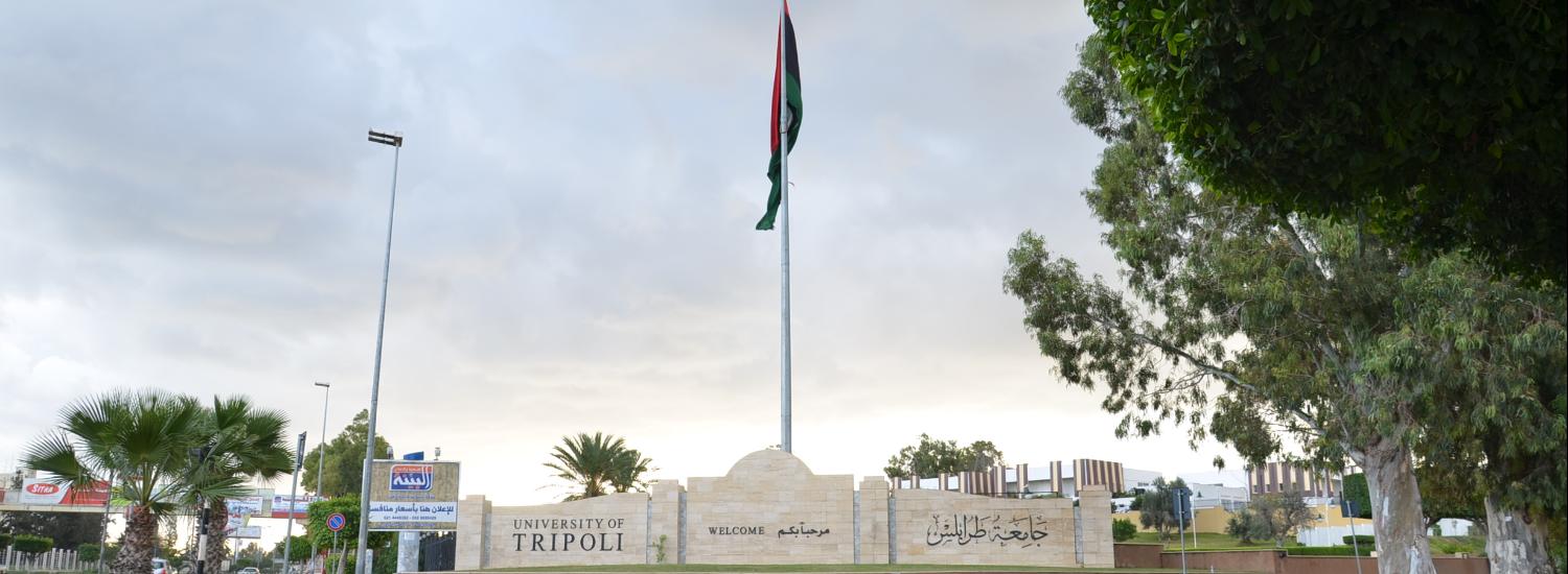
قسم التربة والمياه

المزيد ...

حول قسم التربة والمياه

 افتُتح القسم مع إنشاء كلية الزراعة سنة 1966م، وقد اهتم بالتوسع في مختلف التخصصات المتعلقة بعلوم التربة والمياه وبإعداد الكوادر العلمية القادرة على إدارة وتسيير المشاريع الزراعية أو مواصلة دراستها والحصول على درجات ومؤهلات عالية، كما اهتم بتجهيز المختبرات وتزويدها بمختلف الأجهزة والمعدات الحديثة والمتطورة لاستخدامها في مجالات البحث والدراسة.

حقائق حول قسم التربة والمياه

نفتخر بما نقدمه للمجتمع والعالم

73

المنشورات العلمية

26

هيئة التدريس

52

الطلبة

0

الخريجون

من يعمل بـقسم التربة والمياه

يوجد بـقسم التربة والمياه أكثر من 26 عضو هيئة تدريس

staff photo

د. حمدي عبدالخالق علي الزرقاني

Dr. Hamdi A. Zurqani is one of the faculty members at the Department of Soil and Water Sciences, Faculty of Agriculture, University of Tripoli, Tripoli, Libya. Dr. Zurqani is a recognized expert as a result of his internationally acclaimed work in the areas of Environmental Information Science, Remote Sensing, Land Evaluation, Sustainability, Pedology, and Soil Science Education. He has conducted research across the world, including the United States of America, and Africa. Dr. Zurqani is a distinguished soil scientist with a wide range of scientific and working experiences in Libya and abroad. He received his M.Sc. (2010) from the University of Tripoli, Tripoli, Tripoli, Libya, and Ph.D. (2019) from Clemson University, Clemson, SC, USA. His major research and teaching activities at the University of Tripoli have focused mainly on Soil Genesis and Classification and the Environmental Information Sciences (Remote Sensing and Geographic Information System). He has published broadly in many journals (e.g., Nature “Scientific Reports”, Geoderma; International Journal of Applied Earth Observation and Geoinformation; Journal of Geological Sciences; Land; Frontiers in Environmental Science; Communications in Soil Science and Plant Analysis; and others). Dr. Zurqani is a member of the Editorial Board for Remote Sensing (MDPI) Journal, counseling outcome and research evaluation. He also was appointed to serve as a Guest Editor for the Special Issue "Applications of Remote Sensing in Earth Observation and Geo-Information Science". In addition, Dr. Zurqani conducted peer-review for many journals including Journal of Environmental Informatics, Applied Sciences, SN Applied Sciences, Remote Sensing, Heliyon, Geosciences, Land, Water, Agronomy, Agriculture, Sustainability, Arid Land Research and Management, International Journal of Environmental Research and Public Health, Natural Hazards, and Conference of the Arabian Journal of Geosciences. He is also one of the authors of the lab manual entitled “GIS Exercises for Natural Resource Management”. Dr. Zurqani has been the recipient of numerous awards and honors: Recipient of Douglas R. Phillips Award for Graduate Students, Department of Forestry and Environmental Conservation, Clemson University, April 12, 2019; the First Place Best Judged Poster (CAFLS) at the GRADS 2019: Clemson Student Research Forum on April 4, 2019; the Second Place Poster at the 11th Clemson Biological Sciences Annual Student Symposium, April 6, 2019; the Second Place Best Judged Poster at the Clemson Student Research Forum on April 4, 2018; and the Third Place Poster at the 9th Clemson Biological Sciences Annual Student Symposium, February 25, 2017. Dr. Zurqani conducts cutting-edge research in the field of environmental information science, remote sensing, land use management/planning, change detection of landscape degradation, and geographic information system (GIS) models. He has focused on his research efforts on the development of new technologies in the field of environmental information sciences, geo-intelligence (advanced geo-information science and earth observation, machine and deep learning, and big data analytics), remote sensing, land evaluation, pedology, land use management/ planning, monitoring and evaluating sustainable land management, change detection of landscape degradation, and geographic information system models.

منشورات مختارة

بعض المنشورات التي تم نشرها في قسم التربة والمياه

تتبع معدل معدنة النيتروجين والكتلة الحية في خليط من التربة والسماد العضوي(مخلفات الدواجن)

اُجريت هذه الدراسة المعملية خلال فصل الصيف (2013) حيث تم تجميع كمية كافية من التربة على عمق (20cm) من مزرعة كلية الزراعة-جامعة طرابلس، ثم نقلت إلى المعمل لتجفيفها هوائياً وتفكيك التكتلات الترابية ثٌم غربلتها بغربال قطره (2mm) لفصل الحصى وإجراء التحاليل الأولية للتعرف على خصائصها الطبيعية والكيميائية المبينة في جدول (1،2) وبعد العمليات التي أُجريت على كل من السماد العضوي (مخلفات الدواجن) والتربة أُخذت عينة تربة وزنها (500gm) ثم أضيف إليها السماد العضوي بمعدلات (0 -10 -20 -30 طن/ه) وخلطت جيداً، ثم كررت كل معاملة (3) مرات خلال فترات التحضين والتي حددت بالأسابيع وضعت التربة في الأصص عند درجة حرارة الغرفة مع متابعة الرطوبة من حين إلى آخر للمحافظة عليها عند السعة الحقلية (بالطريقة الوزنية)، أجريت التحاليل الكيميائية والحيوية للعينات المعاملة على امتداد فترات التحضين (0–8أسابيع) وتم تحليل البيانات المتحصل عليها وفقاً للتصميم الإحصائي CRD)). أظهرت نتائج الدراسة أن هناك تغيرات طفيفة في درجة تفاعل التربة والذي قد يعزى إلى وجود كربونات الكالسيوم في السماد والتربة، وسجل إرتفاع طفيف في درجة التوصيل الكهربائي ds/m9.55=EC خلال فترات التحضين، وهذا نتيجة إلى وجود نسبة عالية من الأملاح في سماد الدواجن، أما بالنسبة إلي كمية النيتروجين في التربة (NH+4-NO-3 -Total-N) فقد سجل تذبذب في كمية النيتروجين خلال فترات التحضين وهذا نتيجة لتحلل السماد العضوي بواسطة الأحياء الدقيقة في التربة، وذلك مع وجود تركيزات ملحوظة من النترات في مياه الري أما بالنسبة للمادة العضوية فحدث لها إنخفاض تدريجي من بداية فترة التحضين إلى نهايتها وتصاعد غاز(CO2) هذا دليل على تحللها بواسطة الكتلة الحية في التربة، أما بالنسبة إلى الكتلة الحية وتأثرها بمعدلات إضافة السماد وفترات التحضين فقد لوحظ وجود تفاوت في أعداد المستعمرات، فكلما زادت كمية إضافة السماد في بداية فترة التحضين كانت أعدادها ثابتة ومع مرور الزمن لوحظ زيادة في أعدادها، وهذا يدل على وجود مواد صعبة التحلل تحتاج إلى فترة زمنية طويلة، حيث لوحظ من (6-8 أسابيع) تكون الكتلة الحية أكثر عدداً وهذا دليل على تحلل السماد العضوي خلال فترات التحضين . Abstract A laboratory study was conducted to investigate Nitrogen transformation in Soil and poultry manure mixture, This study was carried out during summer 2013. Uncultivated sandy loam Soils to a depth of 20cm were collectedfrom the faculty of Agriculture farm University of Tripoli, Libya.500 grams of sandy loam Soils was mixedwell with poultry manure at different application rates of 0,10,20,30 Ton/ha with three replicates, then all treatments were incubated at room temperature under field capacity for 0,2,4,6,8 weeks for each treatment. Collected data were subjected to statistical analysis according to statistical design (CRD). The results showed a slight increase in pH during all time of incubation presumably due to the presence of calcium carbonate in Soil and manure. The results also showed marked increase in Electrical conductivity (EC) with all rates of poultry manure addition, this may be due to the presence of high concentration of salts in poultry manure. (EC = 9.55dS/m).Total Nitrogen and Inorganic Nitrogen (NO-3 and NH+4) showed fluctuation during different incubation period. This fluctuation was due to transformation of Nitrogen between mineralization and immobilization as a result of microbial population successive activities.This nitrogen transformation are governed by Nitrogen content, C/N Ratio and manure type and rate. The organic matter showing a dramatic amount of degradation due to the high microbial activity, while the results showed a gradual decrease in CO2 emission along all incubation periods up to 8 weeks, this is mainly due to differences in manure rates and differences in incubation period as well. In this experiment it was oberved that the number of colonies have increased rapidly with increased incubation time which indicates that there were certain compounds are hardly to decompose, which obviously need a longer time to degrade the higest population density was reported in 6 to 8 weeks.
عبد الناصر عبد القادر محمد محمود (2015)
Publisher's website

تقييم المعاملات الهيدرولوجية في منطقة سد وادي كعام

أجريت هذه الدراسة على حوض وادي كعام من واقع ما توافر من بيانات ومعلومات للفترة 1980 -2004، وذلك لتقييم عملية حصاد مياه الأمطار من خلال دراسة بعض المعاملات الهيدرولوجية والتي من أهمها الهطول والجريان السطحي وكذلك البخر. ومن خلال تحليل البيانات وجد أن عمق الهطول المحسوب بطريقة ثيسن 200.6 ملم أما عن طريق خطوط تساوي المطر 202.4 ملم، معدل حجم الجريان السطحي الذي إنساب للبحيرة 17.3 مليون م3، وأن معامل الجريان السطحي للمنطقة الذي تم حسابه من النسبة بين حجم ما يصل لبحيرة السد من مياه الأمطار إلى الحجم الكلي للهطول 3.2 % ، ولدراسة البخر في المنطقة تم استخدام برنامج كروبوات الذي أساسه معادلة بنمان – مونثيت ومدخلاته بعض المعلومات المناخية المتمثلة في الرطوبة النسبية ، متوسط درجات الحرارة الشهرية العظمى ، متوسط درجات الحرارة الشهرية الصغرى ، سرعة الرياح ووجد أن المعدل العام لعمق البخر طوال فترة الدراسة 1532.9ملم ، أما معدل حجم البخر الكلي من سطح البحيرة كان 4668014.2 م3 ، تم حساب المعدل العام للرشح من خلال الموازنة المائية لبحيرة التخزين طوال فترة الدراسة كان 4.2 مليون م3 وهي تعبر عن معدلات التغذية للخزان الجوفي ، تم حساب معدل الإطماء بأخذ النسبة بين حجم الرواسب وحجم المياه المتدفقة لبحيرة التخزين ، معدل الإطماء في بحيرة تخزين المياه يبلغ حوالي 8.2 x 410 م3 / سنة ، تعتبر هذه القيمة مؤثرة جداً على عمر السد لو إستمرت بمعدلاتها الحالية . أوصت الدراسة بضرورة إستخدام ما يتم حصاده من مياه الأمطار في أغراض التنمية الزراعية بالمنطقة ودراسة إجراء عمليات تغذية الخزان الجوفي عن طريق حفر آبار لحقن المياه للخزان الجوفي مباشرة أو للإستمرار في عمليات ضخ المياه للمزارع ولو بدون أي مقابل تلافياً لإرتفاع فقد تلك المياه بالبخر، كما أوصت الدراسة بضرورة إتباع أساليب مقاومة التعرية والإنجراف خصوصاً على مجاري الأودية. Abstract This study is conducted in Wadi Caam dam area, that located around 130 Km east of Tripoli city. The dam is an earth fill dam with catchment area around 2312 km2. The purpose of the dam is to supply water for agriculture downstream of the dam and recharging the groundwater aquifer in the area. The main goal of this study is to investigate the impacts of dam construction on some hydrological parameters due to changes in human activities because of the dam construction. The second goal is to estimate the groundwater recharge from the lake of the dam based on the hydrologic cycle concept. The climatic data used in this study covers 20 years of time period (1979 – 2005) and include temperature, humidity, wind speed, and rainfall. These data are collected for different climatic stations inside and near the catchment area.Based on the climatic data and other related information, the hydrologic parameters are determined. The average annual rainfall depth in the area is determined based on Theissen polygon and isohyets methods. The average annual depth is 200.6 mm for Theissen and 202.4 mm for isohyets. These values considered high Compared with hydroproject value which is 181 mm. According to stream flow measurements, the average annual runoff volume during the period of study is 17.3 x10⁶ m3. This value is closed to hydroproject value that is 19.6 X10⁶ m3 .According to the relation between rainfall and runoff, the average runoff coefficient during the period of study is found to be 3.2 %. This value is considered low compared with hydroproject value that is about 5.5%. The modified penman-monteith formula is used to determine the average annual evaporation applying the software (cowpat). The estimated annual evaporation is 1532.9 mm which is very closed with Hadroprogect, which is 1500 mm. According tow this evaporation rate, the average annual evaporation from the dam lake is 4.7 x10⁶ m3.Water budget method is applied to determine the annual Infiltration through the lake which is found to be about 5.1 x10⁶ m3. This value is highly different from hydroproject value witch is 10X106 m3.The annual sedimentation in Dame Lake is calculated from the annual changes in dead storage level. The annual sedimentation rate per cubic meter of incoming flow during the period of study is about 4.66x10⁻³ m3
عبد المعطي عياد محمد زريبة (2010)
Publisher's website

دراسة حساسية الخزانات الجوفية السطحية للتلوث باستخدام نموذج دراستك (حالة دراسية: سهل الجفارة)

تعتبر المياه الجوفية المصدر الرئيس ي المستخدم لإمداد غالبية المجالات الزراعية والصناعية والمدنية في منطقة سهل الجفارة. وقد أدى نمو النشاطات الزراعية والصناعية فى المنطقة إلى وجود العديد من النواتج والمخلفات الصناعية التي تترك فى العادة فوق سطح التربة، مما قد يعرض مخزون الماء الجوفي السطحي للتلوث، لذلك تم فى هذه الدراسة استخدام نموذج دراستك ( DRASTIC ( فى بيئة نظم المعلومات الجغرافية من أجل إنتاج خرائط مكانية للتنبؤ بمدى حساسية المياه الجوفية السطحية للتلوث، وتحديد درجات حساسية هذه الخزانات للتلوث، ووضع خرائط توزيع مكاني لكافة خصائص نموذج دراستك من خلال تطبيق طريقة مقلوب المسافة الوزنية ) IDW ( في بيئة نظم المعلومات الجغرافية. أوضحت النتائج أنه عند استخدام طريقة مقل وب المسافة الوزنية أمكن الحصول على خرائط مكانية لكافة خصائص نموذج دراستك، وأظهرت أن خرائط التوزيع المكاني لهذه الخصائص يمكن الوثوق بها، وذلك بالحصول على قيم الجذر التربيعي لمتوسط مربع الخطأ ) RMSE ( كأحد مقاييس تقييم جودة القيم المتنبأ بها؛ حيث وجدت أن قيم RMSE تقترب من الصفر، وأن التباين البسيط ما بين قيم RMSE لخصائص نموذج دراستك راجع إلى التباين فى عدد العينات المستخدمة فى هذا النموذج. أشارت النتائج – أيضا إلى أن غالبية أجزاء المنطقة صنفت إلى - متوسطة الحساسية باستثناء بعض المناطق الشمالية الغربية من منطقة الدراسة التي كانت أكثر حساسية للتلوث مقارنة بالمناطق الأخرى، وللتأكد من صلاحية نموذج دراستك ) DI ( تم معايرته مع عدد 9 من عينات مياه الآبار فى الخزان الرباعي الموجود فى المناطق المروية تم فيها تقدير تركيز النترات، وتبين أن هناك ارتباط خطي قوي بين مؤشر دراستك ) DI ( والتغير فى تركيز النترات بمنطقة الدراسة؛ حيث بلغ معامل الارتباط الخطي 0.84 ، مما يشير إلى صلاحية النتائج المتحصل عليها من هذه الدراسة، وبالتالي فإن هذه الدراسة توص ي بحماية المياه الجوفية السطحية والتقليل من خطر التلوث وذلك لاستدامة مصادر المياه الجوفية فى المنطقة.
مختار محمود مختار العالم, يونس ضو زايد الزليط, عبد المطلب غيث عبد السلام(3-2019)
Publisher's website